GR-92 from l'Ametlla de Mar to l'Ampolla: the hidden-cove stage of the Costa Daurada

A coastal walk between cliffs, watchtowers and turquoise waters, with the train included for the way back

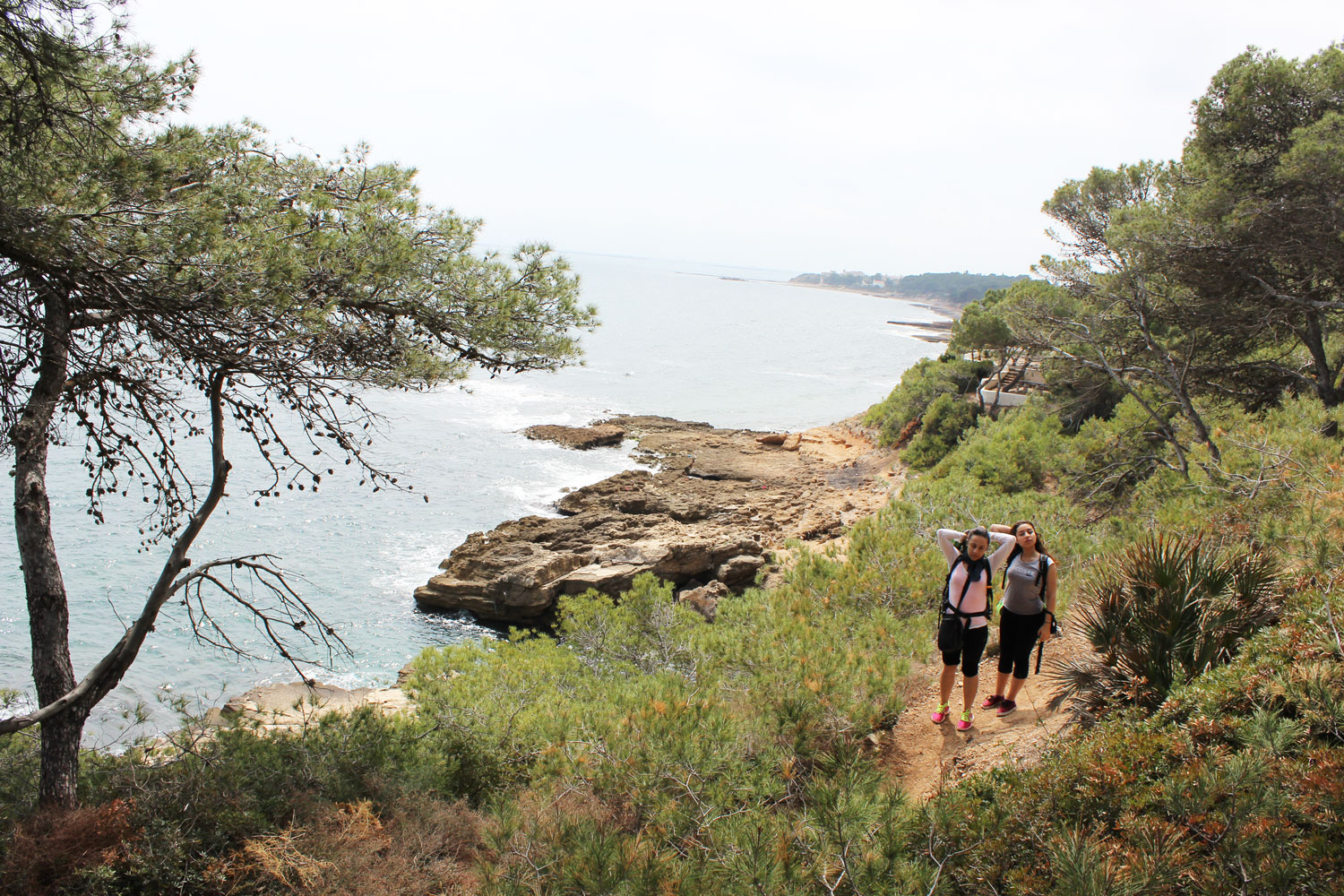
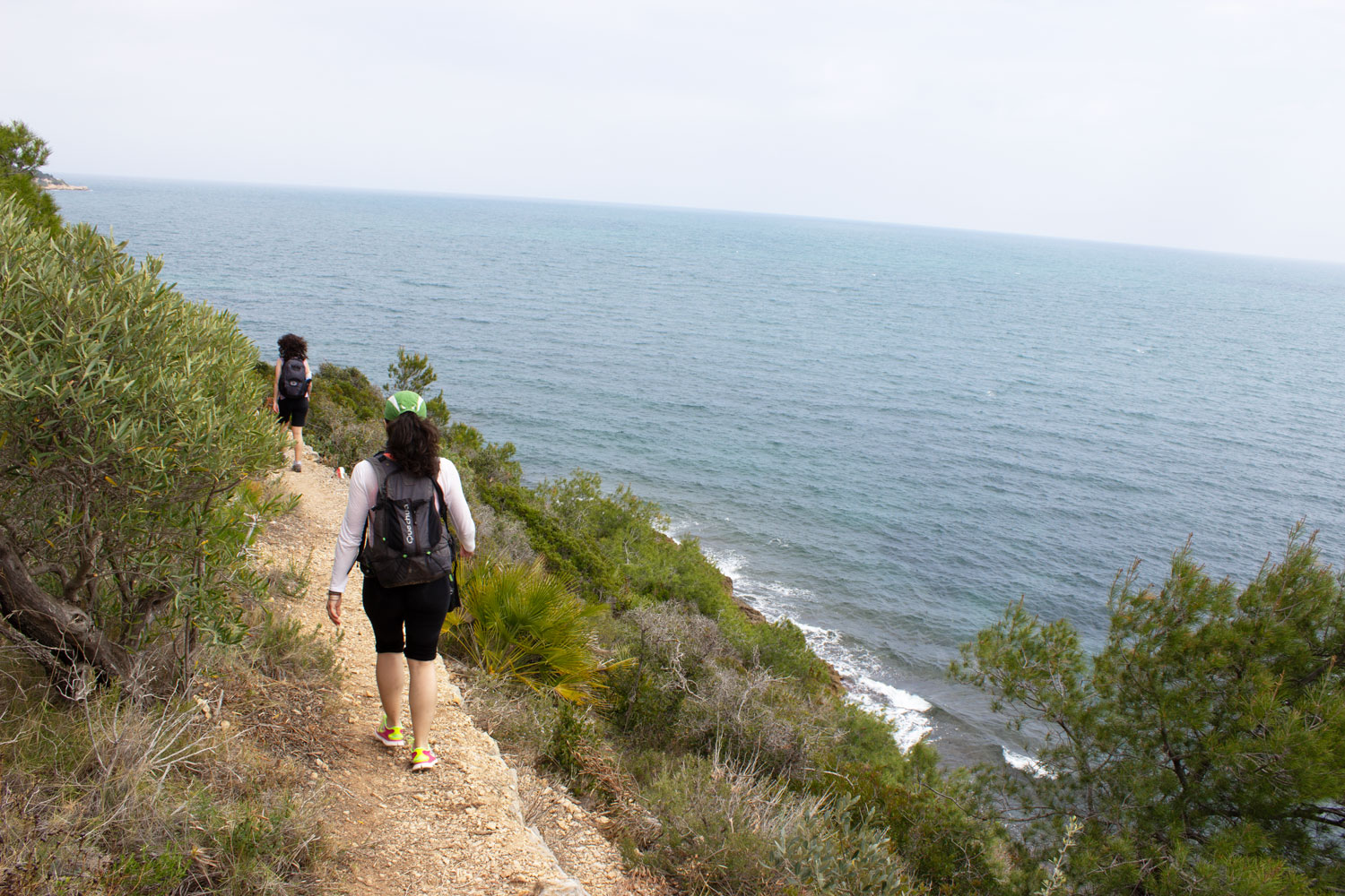
The other day we laced up our boots for stage 29 of the GR-92, known as the Mediterranean Trail, between l'Ametlla de Mar and l'Ampolla. It's one of those stretches of coast that feel like they belong to another era: low cliffs, tiny coves with clear water, and no sign of any development. We took it slow, camera in hand, stopping at every cove along the way, and the result was one of those hikes you enjoy as much for the scenery as for the feeling of walking a piece of coastline that has barely changed in decades.

Here are our notes, curiosities and practical tips: where the trail starts and ends, which coves you'll find along the way, a bit of local history, and how to get around by Renfe train so you don't have to leave the car halfway or walk the same stretch twice.

GR92 Ametlla - Ampolla

1. Where it is and what the route is like

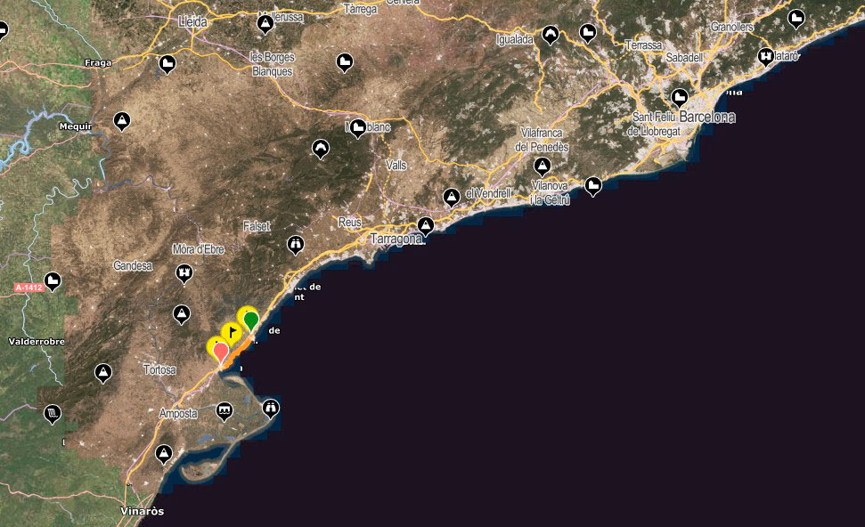
This stage is part of the GR-92, the long-distance trail that runs along the entire Catalan coast from Portbou to Ulldecona and also connects to the European E-10 trail. The section covered here runs entirely along the coastline of the Baix Ebre and Montsià areas, in the province of Tarragona, following the old camí de ronda: the path once used by coastal guards and fishermen to watch over the shoreline.

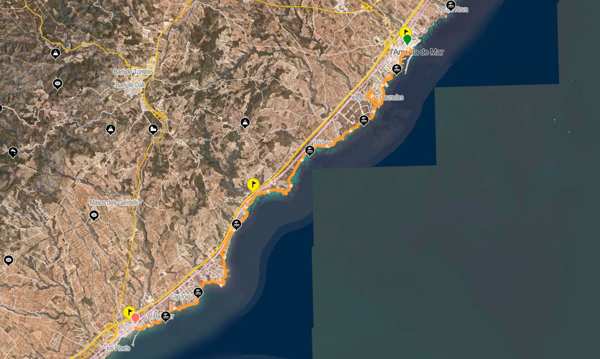
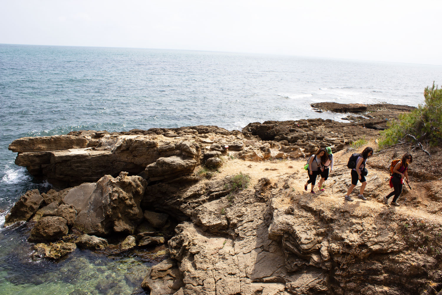
Key fact: the route is about 16 km long and usually takes 4-5 hours at an unhurried pace. Total elevation gain is around 200-250 metres, spread across a constant up-and-down between coves, so while it's technically easy, it can feel demanding in summer because of the heat and the rocky terrain in some sections.

The camí de ronda wasn't originally built as a hiking trail but as a coastal watch path: for centuries it allowed guards and fishermen to patrol the shore on foot, keeping an eye out for landings and spotting boats from the cliffs. Over time, that practical route has become one of the most beloved trails in Mediterranean hiking, and the GR-92 has gradually incorporated it, stretch by stretch, into its north-to-south route across Catalonia.

The full GR-92 runs along the entire Catalan coast, from Portbou, on the French border, to Ulldecona, right at the edge of the Valencian Community. It's also part of the European E-10 trail, which continues into France on one side and into Valencian territory on the other. The stage linking l'Ametlla de Mar with l'Ampolla is number 29 of that overall route, and is considered one of the most beautiful stretches along the entire Costa Daurada.
GR92 Ametlla - Ampolla

2. The coves and hidden spots along the way

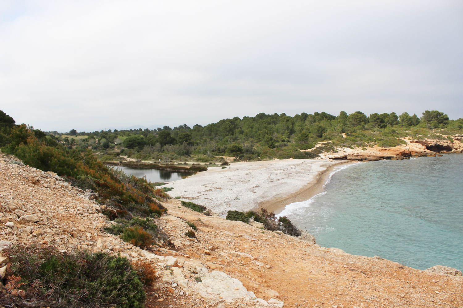
The usual starting point is Platja de l'Alguer, on the seafront promenade of l'Ametlla de Mar, very close to the fishing port. From there, the trail strings together a series of small coves, most of them rocky and with very clear water: Cala de l'Estany Podrit, Cala de Santes Creus, Cala Forn and, closer to l'Ampolla, the well-known Cala de l'Àliga, one of the most photographed spots on the whole route for its greenish-turquoise colour.

Along the way you'll also spot remains of bunkers, trenches and gun emplacements from the Spanish Civil War, as well as the outlines of old watchtowers such as the Sant Jordi d'Alfama tower, a reminder of the days when this coast was guarded against Barbary pirate raids. In the final stretch before reaching l'Ampolla, the cliffs change colour and turn a striking orange, a beautiful contrast against the blue of the sea.

Fun fact: although the route passes through two municipalities, it doesn't actually go through any town in between: between l'Ametlla de Mar and l'Ampolla the path stays right along the coast, with no villages along the way, just the odd isolated house and the Balcó de l'Estany restaurant by the cove of the same name.
If you're hiking with kids or would rather do a shorter version, you can reach Cala de l'Àliga without walking the full stage: it's just over 5 km from l'Ametlla de Mar, or about 7 km if you start from l'Ampolla. A there-and-back trip to the same starting point, with time for a swim and photo stops, can easily stretch to 5-6 hours.
GR92 Ametlla - Ampolla

3. Nature: pine trees, cliffs and a lagoon with unique fish

Beyond the coves, the trail crosses well-preserved Mediterranean vegetation, with pine groves that in places reach almost down to the water's edge, alongside the low scrubland typical of the Catalan coast. It's no coincidence that this stretch of the GR-92 is also known, rather poetically, as the path "where the pines fall in love with the sea".

The Santes Creus area, next to the cove of the same name, is classified as a natural area of interest: it's home to one of the few remaining colonies of the Spanish toothcarp (fartet) and the Valencia toothcarp (samarugo), two small brackish-water fish endemic to eastern Spain and currently endangered. Also worth a mention is the old natural harbour of l'Estany, a fishing shelter used before the modern port of l'Ametlla de Mar was built, which today remains one of the quietest spots along the route.

GR92 Ametlla - Ampolla

4. The two towns: l'Ametlla de Mar and l'Ampolla

Even though the trail itself doesn't pass through any town along the way, it's worth getting to know a little about the two municipalities that serve as its start and finish points, since both have their own character and a very close relationship with the sea.

L'Ametlla de Mar was founded in 1775, when a group of fishermen from Grau de València sought shelter from the wind along this coast and founded the village of Cala de l'Ametlla, then part of the municipality of El Perelló. It didn't become an independent municipality until 1891. Today its population of just over 7,000 is popularly known as "caleros", a nod to the many coves scattered along its shoreline, and the town still lives largely off fishing: it's one of Catalonia's most important fishing ports and, in recent decades, has also become a world reference for bluefin tuna farming and trade, with local companies exporting to dozens of countries.

L'Ampolla, on the other hand, is a younger municipality — it split off from El Perelló in 1989, although it had already been declared a municipality in 1937 — and serves as one of the gateways to the Ebro Delta, one of the most important wetlands in the western Mediterranean. Walking there from l'Ametlla de Mar and watching the cliff landscape gradually give way to the flat delta plain is one of the best ways to grasp the geographical contrast of this stretch of the Tarragona coast.

Key fact: the famous orange cliffs visible in the final stretch, close to l'Ampolla, mark that transition very visibly: they're the last rocky outcrops before the coastline flattens out completely as it enters the Ebro Delta.
GR92 Ametlla - Ampolla

5. Getting there and back by Renfe

The great advantage of this stage is that it can be done point-to-point without the hassle of a car, because both l'Ametlla de Mar and l'Ampolla have train stations on the Media Distancia Regional Exprés line connecting Barcelona with Tortosa, Vinaròs and Valencia. The journey between the two stations takes just 8-10 minutes.

Our recommendation is to leave the car at the destination station and take the train to the starting point, so you don't have to retrace your steps at the end. L'Ametlla de Mar station is a short walk from the seafront promenade and Platja de l'Alguer; l'Ampolla station (l'Ampolla-El Perelló-Deltebre) is also very close to the port, just across the tracks as you enter the town.

Practical tip: regional trains on this line aren't very frequent (only a handful of services a day), so it's worth checking the schedule on the Renfe app or website before leaving home rather than assuming there'll be a train "every so often". A ticket between the two stations costs around 3 euros, and the short train ride is a nice way to rest your legs before or after the hike.

Another option, if you're coming from Barcelona or Tarragona, is to use the same regional line for a full day trip: take the regional train to l'Ametlla de Mar in the morning, walk the trail to l'Ampolla, and catch the train again there, either heading back north or continuing south towards Tortosa. This line also connects, with a bit more travel time, to Valencia on one end and Barcelona on the other, so if you fancy stringing together several stages of the GR-92 over different days, getting around by train is quite convenient.

If you'd rather drive and still do the route point-to-point, a common alternative is to leave the car at the destination station and use the train only for the initial trip to the starting point, avoiding having to move the car twice. There's also a bus service between the two towns, although it runs less often than the train and doesn't stop as close to the start of the trail.
GR92 Ametlla - Ampolla

6. When to go and what to bring

Since the trail runs right along the coast with very little shade, spring and autumn are the best times to enjoy it at a relaxed pace. It can also be done in summer, but it's worth setting off early, bringing swimwear to make the most of the coves, and not skimping on water, sunscreen and something to cover your head. Footwear matters more than it might seem: much of the path is rocky with constant short ups and downs, so hiking shoes with good grip are well worth it.

A couple more tips that make a real difference on the ground: bring at least one litre of water per person, since there are no fountains anywhere along the route, and pack insect repellent if you're going in the warmer months, especially in the sections with more vegetation near the coast. Trail markings are generally good, with the classic white-and-red GR signs, so even if you download a GPS track, it's best to trust the physical trail markers above all, since the route has shifted slightly from the old path in a couple of spots.

Practical tip: the middle of the day brings the most heat and the least shade, so if you're going in summer, consider setting off early in the morning or, if the train schedule allows, doing the route in the late afternoon, when the low light on the orange cliffs in the final stretch is especially beautiful for photos.
GR92 Ametlla - Ampolla

Frequently asked questions

Is the stage from l'Ametlla de Mar to l'Ampolla difficult?

It's technically easy and well signposted, but the rocky terrain and constant ups and downs make it a bit more demanding than it looks on paper, especially in hot weather.

Can you take the train back to the starting point?

Yes, both l'Ametlla de Mar and l'Ampolla have Renfe stations on the same regional line, with a journey of just 8-10 minutes between them, which lets you do the route point-to-point without needing two cars.

Are there any towns along the way to stop for food or drink?

There are no towns in between, so it's best to bring enough water and food. The only landmark along the way is the Balcó de l'Estany restaurant, next to one of the coves.

Which is the best cove on the route for swimming?

Cala de l'Àliga tends to be the most celebrated for its turquoise colour and low-cliff setting, although getting into the water is a bit awkward since it's a pebble cove.

Is the route suitable for hiking with children?

Yes, though you should take care on the rocky stretches and consider doing just a short section, such as the there-and-back walk to Cala de l'Àliga, rather than the full 16 km stage.

Is there any shade along the way?

Very little. The trail runs almost entirely in the open along the cliffs, with the occasional stretch of pine forest, so in the hotter months it's important to bring sun protection and avoid the middle of the day.

Can it be done in the opposite direction, from l'Ampolla to l'Ametlla de Mar?

Yes, the route can be walked comfortably in either direction, since both towns have a train station. The choice usually comes down to where you'd rather leave the car, or which direction gives you the best light for the walk.

Product added to wishlist
Product added to compare.

Looking for a mineral? Write us